Maps
Put the old maps next to today: how much have the streets, gates and walls changed over the centuries?
Grand Bazaar
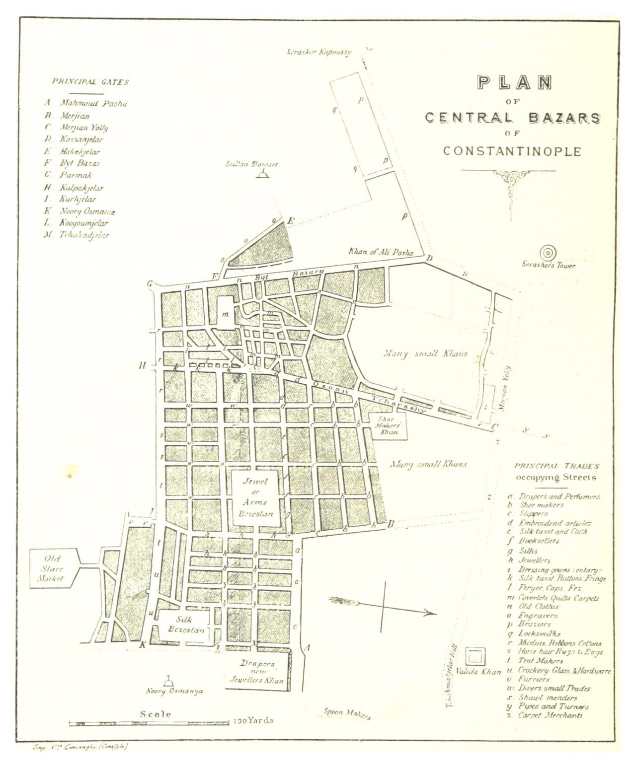
This 1895 plan shows the bazaar's gates, its two bedestens and which trade occupied which street at the time. The street pattern is almost identical today.
 1895
1895
Plan of the central bazaars
The margin lists the gates (letter K is the Jewellers' Gate), the centre shows the Cevahir and Sandal bedestens, and the table on the right names the trades that held each street: jewellers, carpet dealers, tailors, booksellers.
Spry, 1895 · Source
Open full imageGrand Bazaar
© OpenStreetMap
Open in MapsHistoric Peninsula
From the oldest known map of the city to a detailed 19th-century street plan: how the walls, harbours and quarters changed over the centuries.
 1422
1422
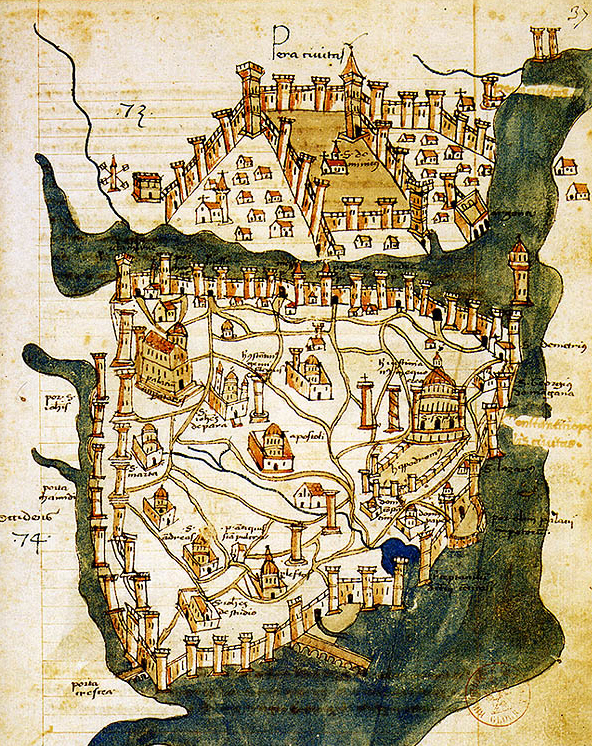
The oldest known map of the city
Drawn by the Florentine priest Cristoforo Buondelmonti, it shows Constantinople 31 years before the conquest: the walls, Hagia Sophia, the Hippodrome and the chain closing the Golden Horn.
Cristoforo Buondelmonti, 1422 · BnF · Source
Open full image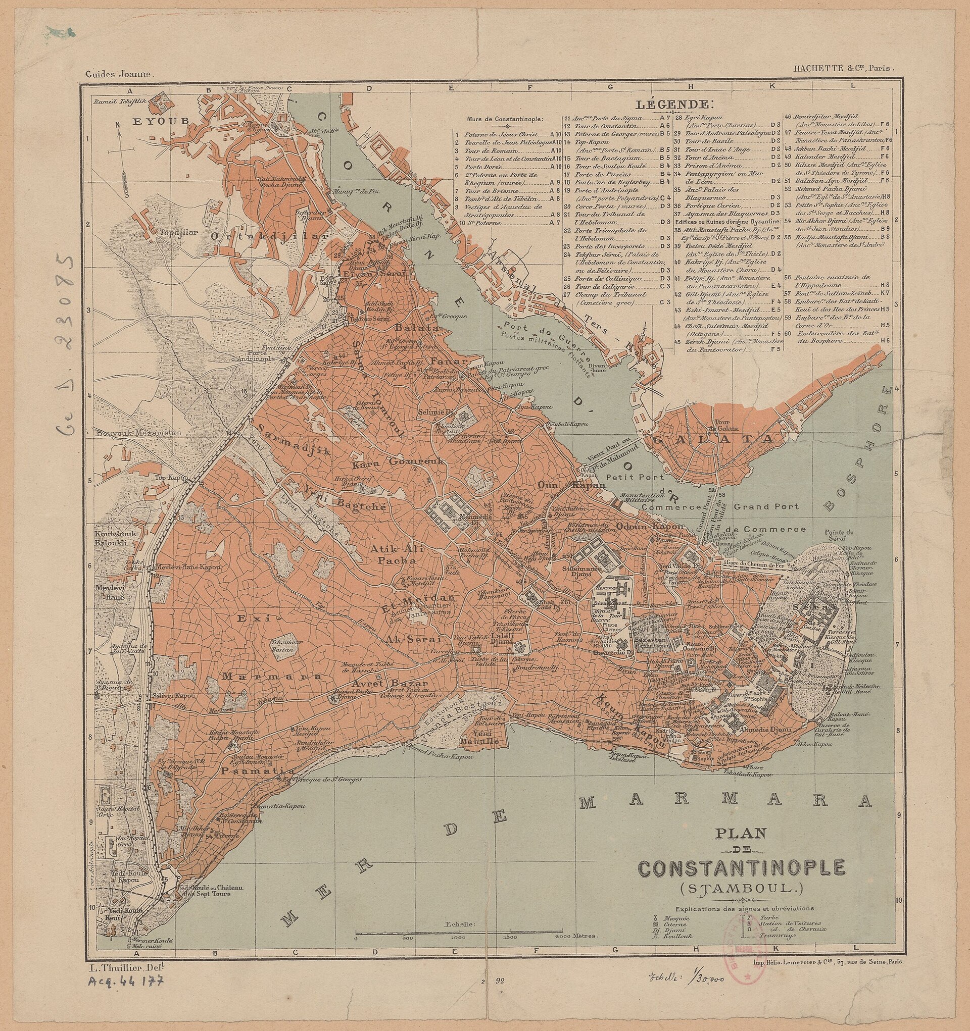 1890
1890
Detailed city plan
Drawn at 1:30,000 for Hachette's travel guide, it marks the land-wall gates, Yedikule, Fener, Balat and the bazaar quarter one by one.
L. Thuillier, Guides Joanne / Hachette, 1890 · BnF · Source
Open full imageHistoric Peninsula
© OpenStreetMap
Open in Maps